Welcome to Vector Force!
We believe in creating designs with a purpose. Our designs reflect our passions, which include fishing, paddling, the great outdoors, movies and TV, pop culture, cartography, Wisconsin culture, organizations, and university spirit.
Strap Storage & Management

Waterproof Paddle Trail Maps
Apparel & Stickers

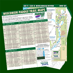
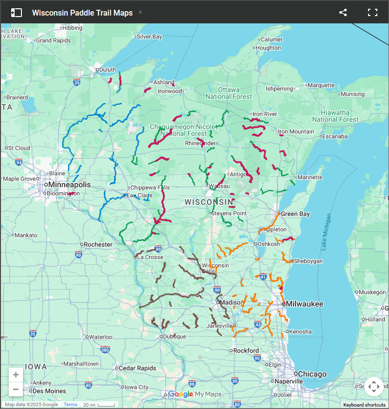
Wisconsin Paddle Trail Maps
The Wisconsin Paddle Trail Maps are waterproof, UV-resistant maps of commonly paddled Wisconsin streams. No need to use a map case or photocopy your outdated guidebook maps. All stream sections were recently scouted to verify details.
Currently available maps are divided into four sets – Central and Northeast Wisconsin, Northwest Wisconsin, Southeast Wisconsin, and Southwest Wisconsin – covering water with no more than Class I+ whitewater or the occasional, easily portaged Class II or higher short rapid, ledge, drop, or dam remnant. The Wisconsin Whitewater series will feature stream sections with Class II or higher whitewater.
Showing 1–12 of 105 results
-

Shop by Design (105)
-

Shop by Product Type (103)
-

Shop by Theme (105)
-

CamReeler
Price range: $14.99 through $26.99 Select options This product has multiple variants. The options may be chosen on the product page -

StrapMaster
Price range: $6.99 through $7.99 Select options This product has multiple variants. The options may be chosen on the product page -

Wisconsin Paddle Trail Maps – Southwest Wisconsin
Price range: $2.99 through $19.99 Select options This product has multiple variants. The options may be chosen on the product page -

Wisconsin Paddle Trail Maps – Southeast Wisconsin
Price range: $2.99 through $19.99 Select options This product has multiple variants. The options may be chosen on the product page -

Wisconsin Paddle Trail Maps – Central & Northeast Wisconsin
Price range: $2.99 through $19.99 Select options This product has multiple variants. The options may be chosen on the product page -

Wisconsin Paddle Trail Maps – Northwest Wisconsin
Price range: $2.99 through $19.99 Select options This product has multiple variants. The options may be chosen on the product page -

Wisconsin Paddle Trail Maps – Wisconsin Whitewater
Price range: $4.99 through $29.99 Select options This product has multiple variants. The options may be chosen on the product page -

Wisconsin Rivers Gazetteer
As low as $5.00 Add to cart -

Wisconsin Rivers Waterproof Map
As low as $2.39 Add to cart -

Wisconsin Rivers Poster
As low as $5.00 Add to cart -
Wisconsin Rivers Gazetteer Seconds 5 Pack
$1.99 Add to cart -

Wisconsin Rivers Map – Raster PDF Download
$4.99 Add to cart
Showing 1–12 of 105 results